Homeland Properties
Sold: 16 Acres | Hwy 59
Land, Panola County
Hwy 59, Carthage, Texas 75633
Listing ID: 46964
16.89 Acres$69,950 Total
Property Description:
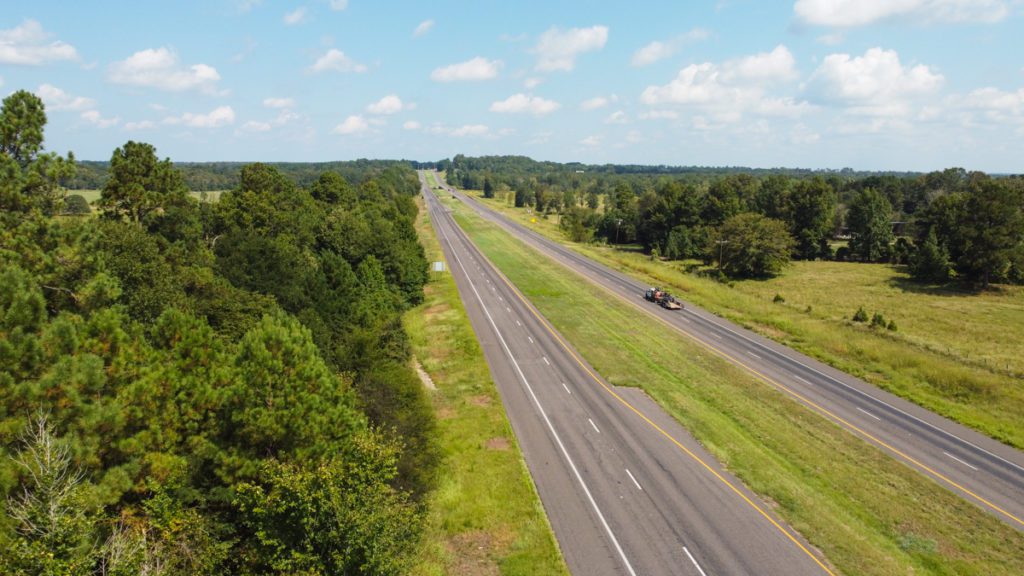
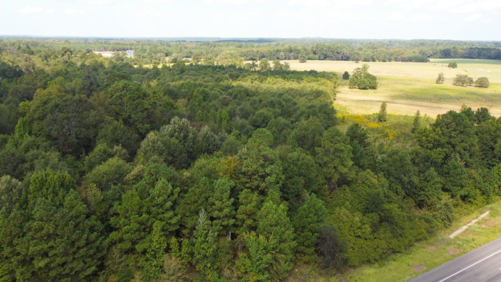
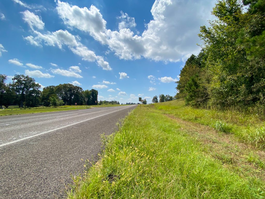
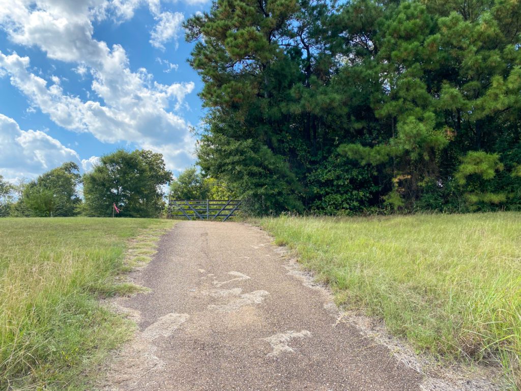
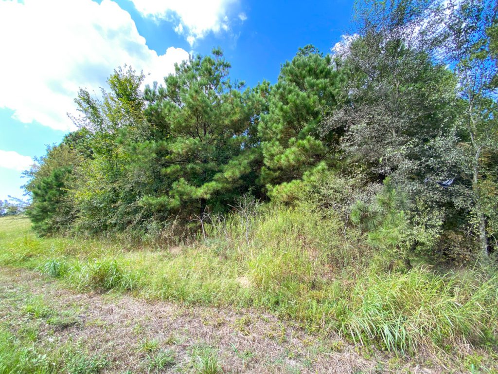
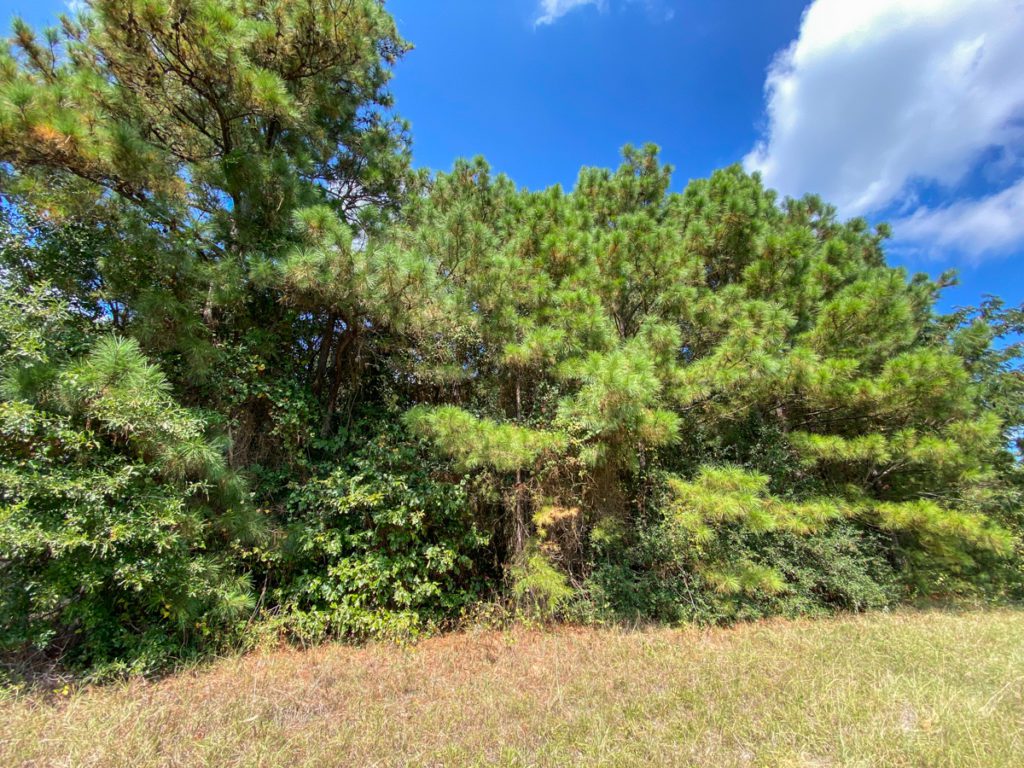
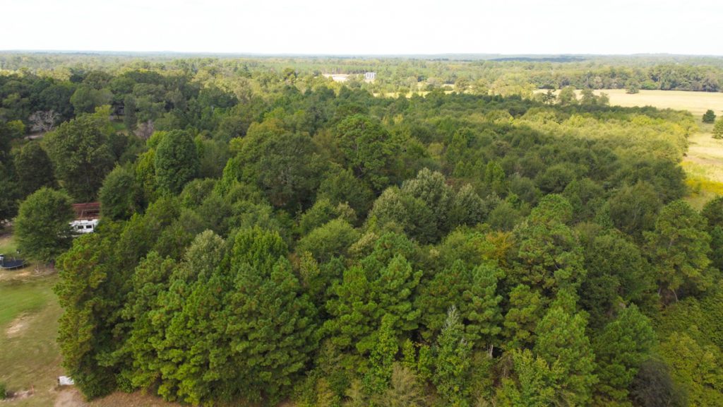
16.89 acres fronting Hwy 59 just North of Carthage, TX. This tract has an entrance already established directly off Hwy 59! Mostly wooded property with fencing on 3 sides. Electricity and water. Ease drive to Carthage, Marshall, Longview, Henderson, and Louisiana!
Other Details
Showing/Viewing Instructions:Buyer &/or agents must notify Homeland Properties of intent to view/tour & make advance appointment. A minimum of 24 hours’ notice is required. Buyers must be accompanied by broker/agent. Licensed co-brokers are welcome to show this property by advance appointment and will receive a co-broker fee if the co-broker accompanies their buyer from the first contact to the closing of a sale.
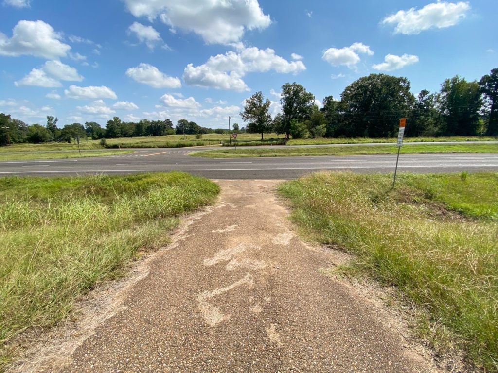
Directions:From Carthage - Take US Hwy 59 N toward Marshall. Property is on the west side of Hwy 59, just north of FM 124.
Access/Frontage:US Hwy 59
Terrain Description:Level to sloping topography. Densley wooded.
Restrictions:None Known
Land Use:Leisure Ranch, Mobile Home Allowed, Unrestricted
Utilities:Electricity, Water District
Utility District(s):ROCK HILL WSC
Legal Description:A-390, W. Lagrone, Panola Co., TX
Corners/Property Lines:Visible and/or marked in field.
School District:Beckville ISD
Financial
Earnest Money:5%
Tax Amount:$1,171.49
Tax Year:2021
Tax ID:17422
Payment Options:Cash Sale, Conventional, Investor
Disclaimers
Listing Disclaimer:The use and/or reproduction of any marketing materials generated by HomeLand Properties, Inc. and/or its associated clients, including, but not limited to, maps, videos, photos, spreadsheets, diagrams, contracts, documents, etc. is strictly prohibited without written consent. The information contained herein is from sources deemed reliable but is not guaranteed by HomeLand Properties, Inc. The offerings are subject to change in price, errors, omissions, prior sales or withdrawal without notice. This disclaimer supersedes any & all information published by other MLS sites whether by permission or not, including, but not limited to, co-broker fees, if any. Acreage size and dimensions are approximate. County Appraisal District (CAD) market and tax values, as well as acreage size and/or shape, are not applicable to real estate market conditions and/or this solicitation, other than for ag value (1D1) purposes.
Legal Disclaimer:Size is approximate and subject to recorded legal description or surveyed gross acres to include, but not limited to, any acres lying within roads & easements. CAD shape files are not reliable. Shape files per maps herein are considered the most accurate available and are derived using the best information available, included, but not limited to, GIS data, field data, legal descriptions, and survey, if available.
Title and Survey Disclaimer:Expense subject to negotiation. Seller requires use of seller's preferred surveyor/title company.
Mineral Disclaimer:Oil and gas minerals have been reserved by prior owners.
Other reservations subject to title and/or sellers contract when applicable.
Easement Disclaimer:Visible and apparent and/or marked in field., Electrical, USDot
Tax Disclaimer:Properties may qualify for future exemption subject to usage.
Property Managers


Property Photos:
-
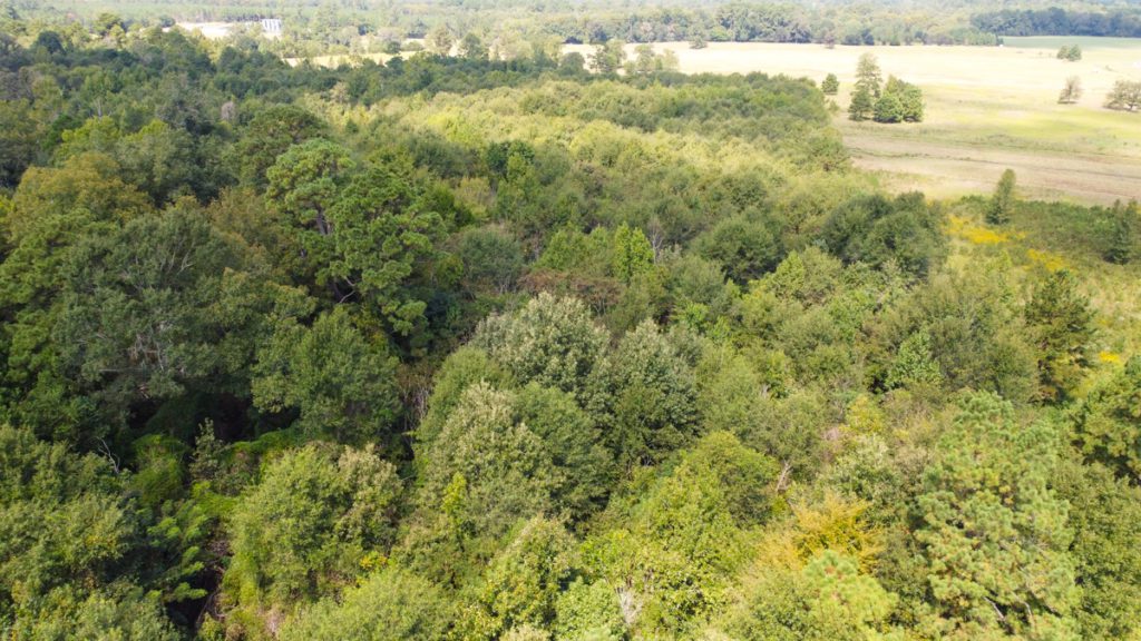
Aerial

-
Topography

-
Location Maps

-
Survey

Showing/Viewing Instructions:Buyer &/or agents must notify Homeland Properties of intent to view/tour & make advance appointment. A minimum of 24 hours’ notice is required. Buyers must be accompanied by broker/agent. Licensed co-brokers are welcome to show this property by advance appointment and will receive a co-broker fee if the co-broker accompanies their buyer from the first contact to the closing of a sale.
Directions:From Carthage - Take US Hwy 59 N toward Marshall. Property is on the west side of Hwy 59, just north of FM 124.
Access/Frontage:US Hwy 59
Terrain Description:Level to sloping topography. Densley wooded.
Restrictions:None Known
Land Use:Leisure Ranch, Mobile Home Allowed, Unrestricted
Utilities:Electricity, Water District
Utility District(s):ROCK HILL WSC
Legal Description:A-390, W. Lagrone, Panola Co., TX
Corners/Property Lines:Visible and/or marked in field.
School District:Beckville ISD
Earnest Money:5%
Tax Amount:$1,171.49
Tax Year:2021
Tax ID:17422
Payment Options:Cash Sale, Conventional, Investor
Listing Disclaimer:The use and/or reproduction of any marketing materials generated by HomeLand Properties, Inc. and/or its associated clients, including, but not limited to, maps, videos, photos, spreadsheets, diagrams, contracts, documents, etc. is strictly prohibited without written consent. The information contained herein is from sources deemed reliable but is not guaranteed by HomeLand Properties, Inc. The offerings are subject to change in price, errors, omissions, prior sales or withdrawal without notice. This disclaimer supersedes any & all information published by other MLS sites whether by permission or not, including, but not limited to, co-broker fees, if any. Acreage size and dimensions are approximate. County Appraisal District (CAD) market and tax values, as well as acreage size and/or shape, are not applicable to real estate market conditions and/or this solicitation, other than for ag value (1D1) purposes.
Legal Disclaimer:Size is approximate and subject to recorded legal description or surveyed gross acres to include, but not limited to, any acres lying within roads & easements. CAD shape files are not reliable. Shape files per maps herein are considered the most accurate available and are derived using the best information available, included, but not limited to, GIS data, field data, legal descriptions, and survey, if available.
Title and Survey Disclaimer:Expense subject to negotiation. Seller requires use of seller's preferred surveyor/title company.
Mineral Disclaimer:Oil and gas minerals have been reserved by prior owners.
Other reservations subject to title and/or sellers contract when applicable.
Easement Disclaimer:Visible and apparent and/or marked in field., Electrical, USDot
Tax Disclaimer:Properties may qualify for future exemption subject to usage.