Homeland Properties
Sold: 4 Acres | T-2 | FM 355
Land, Trinity County
Fm 355, Trinity, Texas 75862
Listing ID: 47040
4.562 Acres$68,430 Total
Owner Financing!
Property Description:
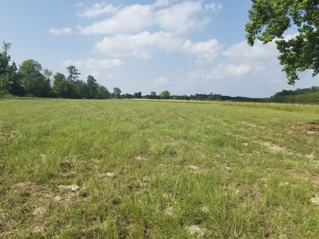
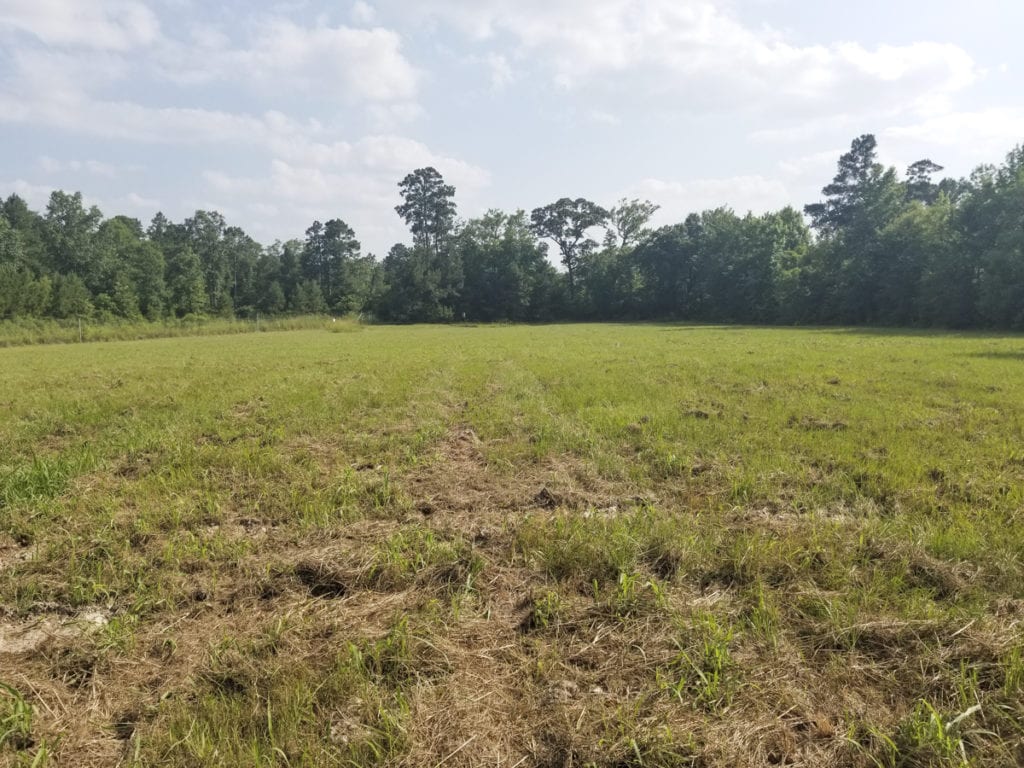
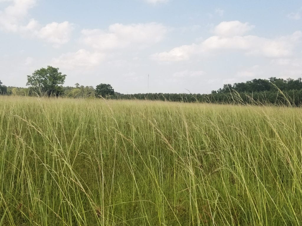
Come escape the traffic, noise, and headaches of the city with this prime 4.5 acre Ranchette. This tract offers the Rural feel with city amenities nearby. Community Water and Electricity are easily available. Do not miss this opportunity, schedule your viewing today!
Owner financing terms: 10% Down, 10% Interest, Amortized on a 15 year note, with a balloon at the end of the 5th year.
Other Details
Showing/Viewing Instructions:Buyer &/or agents must notify Homeland Properties of intent to view/tour & make advance appointment. A minimum of 24 hours’ notice is required. Buyers must be accompanied by broker/agent. Licensed co-brokers are welcome to show this property by advance appointment and will receive a co-broker fee if the co-broker accompanies their buyer from the first contact to the closing of a sale.
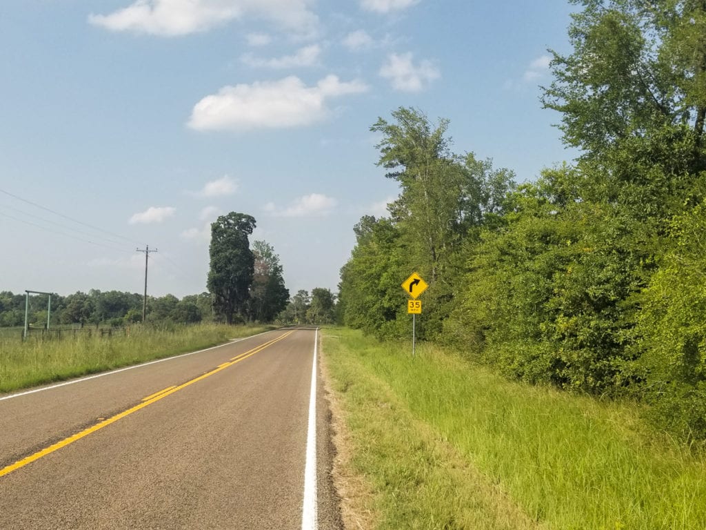
Directions:From Huntsville, take TX 19 North, take TX 94 East/US 287 to Groveton.
From Groveton take FM 355 south approximately 4 miles. Property on left.
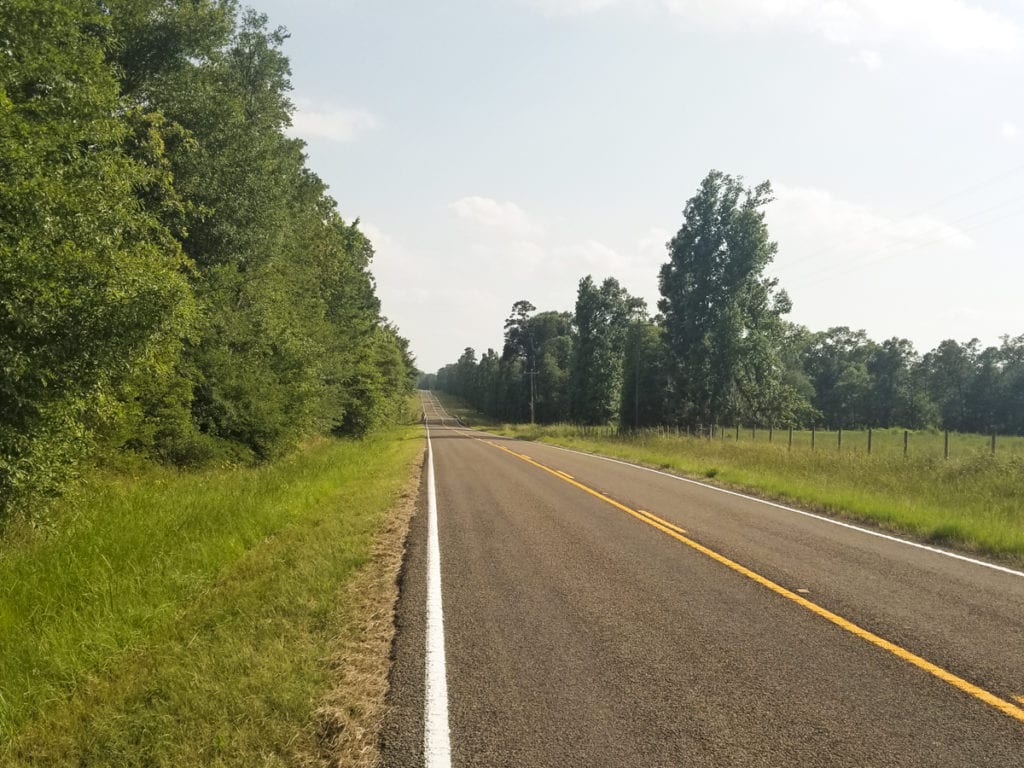
Access/Frontage:FM 355
Terrain Description:Rolling topography. Hay pastureland sloping toward creek drain border. Floodplain maps not available for Trinity County.
Restrictions:Yes
Land Use:Cattle Ranch, Horse Farm, Mobile Home Allowed, Restricted
Utilities:Public Water
Legal Description:STEPHANES, CHARLES Survey, TCT 7&8, A-0568, Trinity Co., TX.
Corners/Property Lines:Property lines on plats are arbitrary and not visible in the field, for illustration purposes only, subject to survey.
School District:Groveton ISD
Financial
Earnest Money:5%
Tax ID:Portion of 55390
Payment Options:Cash Sale, Conventional, Investor
Disclaimers
Listing Disclaimer:The use and/or reproduction of any marketing materials generated by HomeLand Properties, Inc. and/or its associated clients, including, but not limited to, maps, videos, photos, spreadsheets, diagrams, contracts, documents, etc. is strictly prohibited without written consent. The information contained herein is from sources deemed reliable but is not guaranteed by HomeLand Properties, Inc. The offerings are subject to change in price, errors, omissions, prior sales or withdrawal without notice. This disclaimer supersedes any & all information published by other MLS sites whether by permission or not, including, but not limited to, co-broker fees, if any. Acreage size and dimensions are approximate. County Appraisal District (CAD) market and tax values, as well as acreage size and/or shape, are not applicable to real estate market conditions and/or this solicitation, other than for ag value (1D1) purposes.
Legal Disclaimer:Size is approximate and subject to recorded legal description or surveyed gross acres to include, but not limited to, any acres lying within roads & easements. CAD shape files are not reliable. Shape files per maps herein are considered the most accurate available and are derived using the best information available, included, but not limited to, GIS data, field data, legal descriptions, and survey, if available.
Title and Survey Disclaimer:Expense subject to negotiation. Seller requires use of seller's preferred surveyor/title company.
Mineral Disclaimer:Oil and gas minerals have been reserved by prior owners.
Other reservations subject to title and/or sellers contract when applicable.
Easement Disclaimer:Visible and apparent and/or marked in field.,
Listing Agent

Property Photos:
-
Aerial

-
Topography

-
Location Maps

-
Restrictions

Showing/Viewing Instructions:Buyer &/or agents must notify Homeland Properties of intent to view/tour & make advance appointment. A minimum of 24 hours’ notice is required. Buyers must be accompanied by broker/agent. Licensed co-brokers are welcome to show this property by advance appointment and will receive a co-broker fee if the co-broker accompanies their buyer from the first contact to the closing of a sale.
Directions:From Huntsville, take TX 19 North, take TX 94 East/US 287 to Groveton.
From Groveton take FM 355 south approximately 4 miles. Property on left.
Access/Frontage:FM 355
Terrain Description:Rolling topography. Hay pastureland sloping toward creek drain border. Floodplain maps not available for Trinity County.
Restrictions:Yes
Land Use:Cattle Ranch, Horse Farm, Mobile Home Allowed, Restricted
Utilities:Public Water
Legal Description:STEPHANES, CHARLES Survey, TCT 7&8, A-0568, Trinity Co., TX.
Corners/Property Lines:Property lines on plats are arbitrary and not visible in the field, for illustration purposes only, subject to survey.
School District:Groveton ISD
Earnest Money:5%
Tax ID:Portion of 55390
Payment Options:Cash Sale, Conventional, Investor
Listing Disclaimer:The use and/or reproduction of any marketing materials generated by HomeLand Properties, Inc. and/or its associated clients, including, but not limited to, maps, videos, photos, spreadsheets, diagrams, contracts, documents, etc. is strictly prohibited without written consent. The information contained herein is from sources deemed reliable but is not guaranteed by HomeLand Properties, Inc. The offerings are subject to change in price, errors, omissions, prior sales or withdrawal without notice. This disclaimer supersedes any & all information published by other MLS sites whether by permission or not, including, but not limited to, co-broker fees, if any. Acreage size and dimensions are approximate. County Appraisal District (CAD) market and tax values, as well as acreage size and/or shape, are not applicable to real estate market conditions and/or this solicitation, other than for ag value (1D1) purposes.
Legal Disclaimer:Size is approximate and subject to recorded legal description or surveyed gross acres to include, but not limited to, any acres lying within roads & easements. CAD shape files are not reliable. Shape files per maps herein are considered the most accurate available and are derived using the best information available, included, but not limited to, GIS data, field data, legal descriptions, and survey, if available.
Title and Survey Disclaimer:Expense subject to negotiation. Seller requires use of seller's preferred surveyor/title company.
Mineral Disclaimer:Oil and gas minerals have been reserved by prior owners.
Other reservations subject to title and/or sellers contract when applicable.
Easement Disclaimer:Visible and apparent and/or marked in field.,