Homeland Properties
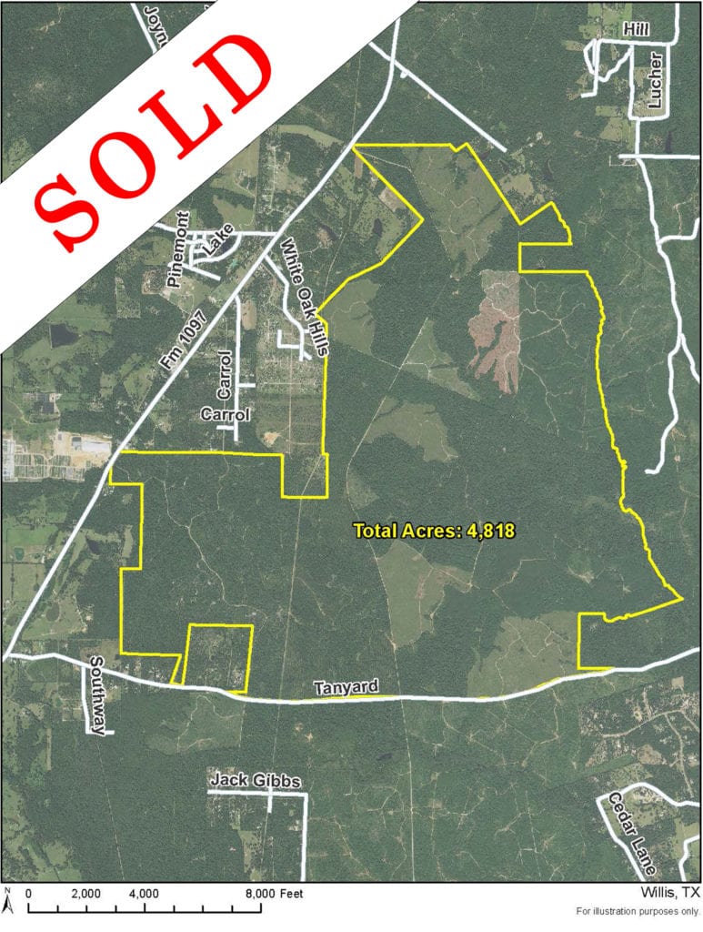
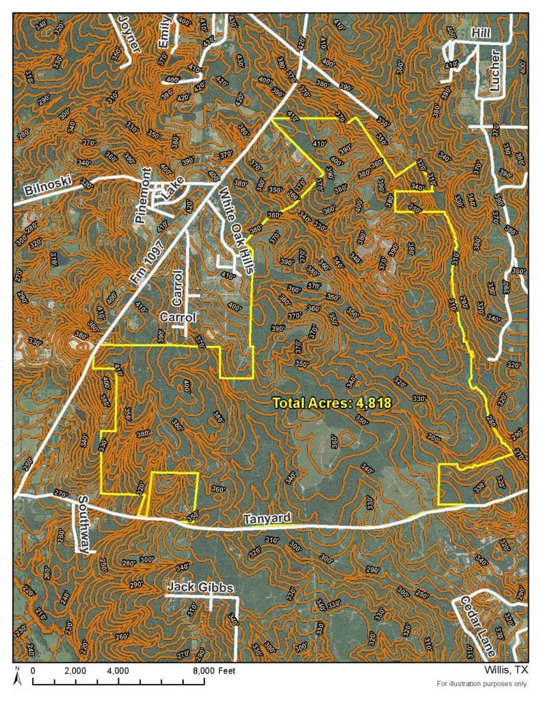
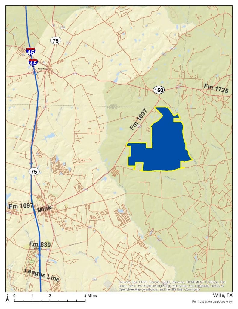
Sold: 4818 Acres | FM 1097/Tanyard Rd
Land, Montgomery County
FM 1097/Tanyard Rd, Willis, Texas 77378
Listing ID: 35717
Call for pricing
Property Description:
First time open market offering. Rare contiguous, large tract for transitional development.
Other Details
Showing/Viewing Instructions:Buyer &/or agents must notify Homeland Properties of intent to view/tour & make advance appointment. A minimum of 24 hours’ notice is required. Buyers must be accompanied by broker/agent. Licensed co-brokers are welcome to show this property by advance appointment and will receive a co-broker fee if the co-broker accompanies their buyer from the first contact to the closing of a sale.
Directions:From Willis, take FM 1097 East to Tanyard Rd. & turn right. Property is on the left.
Access/Frontage:FM 1097/Tanyard Rd
Restrictions:N/A
Land Use:Cattle Ranch, Horse Farm, Horses Allowed, Hunting, Leisure Ranch, Recreation, Timber
Utilities:No Water
Legal Description:A0015 - DE LA GARZA, TRACT 1-A, 3, 4, 6-9 (NORTH OF TANYARD)
Corners/Property Lines:Visible and/or marked in field.
School District:Willis ISD
Financial
Earnest Money:5%
Tax ID:0015-08-00110, 0015-08-00111
Payment Options:Cash Sale, Conventional, Investor
Disclaimers
Listing Disclaimer:The use and/or reproduction of any marketing materials generated by HomeLand Properties, Inc. and/or its associated clients, including, but not limited to, maps, videos, photos, spreadsheets, diagrams, contracts, documents, etc. is strictly prohibited without written consent. The information contained herein is from sources deemed reliable but is not guaranteed by HomeLand Properties, Inc. The offerings are subject to change in price, errors, omissions, prior sales or withdrawal without notice. This disclaimer supersedes any & all information published by other MLS sites whether by permission or not, including, but not limited to, co-broker fees, if any. Acreage size and dimensions are approximate. County Appraisal District (CAD) market and tax values, as well as acreage size and/or shape, are not applicable to real estate market conditions and/or this solicitation, other than for ag value (1D1) purposes.
Legal Disclaimer:Size is approximate and subject to recorded legal description or surveyed gross acres to include, but not limited to, any acres lying within roads & easements. CAD shape files are not reliable. Shape files per maps herein are considered the most accurate available and are derived using the best information available, included, but not limited to, GIS data, field data, legal descriptions, and survey, if available.
Title and Survey Disclaimer:Expense subject to negotiation. Seller requires use of seller's preferred surveyor/title company.
Mineral Disclaimer:Oil & gas minerals have been reserved by prior owners.
Other reservations subject to title and/or sellers contract when applicable.
Tax Disclaimer:Approximately $5/Ac/Yr with timber exemption. Properties may qualify for future exemption subject to usage.
Listing Agents


Property Photos:
-
Aerial

-
Topo

-
Location Map

Showing/Viewing Instructions:Buyer &/or agents must notify Homeland Properties of intent to view/tour & make advance appointment. A minimum of 24 hours’ notice is required. Buyers must be accompanied by broker/agent. Licensed co-brokers are welcome to show this property by advance appointment and will receive a co-broker fee if the co-broker accompanies their buyer from the first contact to the closing of a sale.
Directions:From Willis, take FM 1097 East to Tanyard Rd. & turn right. Property is on the left.
Access/Frontage:FM 1097/Tanyard Rd
Restrictions:N/A
Land Use:Cattle Ranch, Horse Farm, Horses Allowed, Hunting, Leisure Ranch, Recreation, Timber
Utilities:No Water
Legal Description:A0015 - DE LA GARZA, TRACT 1-A, 3, 4, 6-9 (NORTH OF TANYARD)
Corners/Property Lines:Visible and/or marked in field.
School District:Willis ISD
Earnest Money:5%
Tax ID:0015-08-00110, 0015-08-00111
Payment Options:Cash Sale, Conventional, Investor
Listing Disclaimer:The use and/or reproduction of any marketing materials generated by HomeLand Properties, Inc. and/or its associated clients, including, but not limited to, maps, videos, photos, spreadsheets, diagrams, contracts, documents, etc. is strictly prohibited without written consent. The information contained herein is from sources deemed reliable but is not guaranteed by HomeLand Properties, Inc. The offerings are subject to change in price, errors, omissions, prior sales or withdrawal without notice. This disclaimer supersedes any & all information published by other MLS sites whether by permission or not, including, but not limited to, co-broker fees, if any. Acreage size and dimensions are approximate. County Appraisal District (CAD) market and tax values, as well as acreage size and/or shape, are not applicable to real estate market conditions and/or this solicitation, other than for ag value (1D1) purposes.
Legal Disclaimer:Size is approximate and subject to recorded legal description or surveyed gross acres to include, but not limited to, any acres lying within roads & easements. CAD shape files are not reliable. Shape files per maps herein are considered the most accurate available and are derived using the best information available, included, but not limited to, GIS data, field data, legal descriptions, and survey, if available.
Title and Survey Disclaimer:Expense subject to negotiation. Seller requires use of seller's preferred surveyor/title company.
Mineral Disclaimer:Oil & gas minerals have been reserved by prior owners.
Other reservations subject to title and/or sellers contract when applicable.
Tax Disclaimer:Approximately $5/Ac/Yr with timber exemption. Properties may qualify for future exemption subject to usage.