Hi HomeLand Readers,
My name is Robbi Flack. I’m a licensed agent with HomeLand Properties and have been exposed to the real estate industry for 8+ years working at HomeLand. I’ve been a full-time agent since I graduated from Texas Christian University in 2018. I’ve had the opportunity to learn from the best as I work with Andy Flack, (our principal broker), and Karen Stout (broker) to manage our inventory, work with other agents/brokers, and assist buyers. We are often in the field checking inventory, putting new tracts on the market, evaluating a tract for a potential listing, etc. We’ve always emphasized creating quality aerial, topographic, and location maps for clients to understand the shape and location of our tracts, but we also utilize these maps daily when we’re in the field. As technology has advanced, reading physical maps seems to be a learned “skill”. Fortunately, Avenza Maps has made this “skill” easier for everyone. You can utilize Avenza Maps with any of our aerial, topo, or location maps to see exactly where you’re located in reference to the property boundary lines. Check out the step-by-step tutorial below to learn how you can use this app in the field as well!
![]()
Step 1 – Download Avenza Maps from the App Store
Step 2 – Go to our website at www.HomelandProp.com using your mobile device or tablet.
Step 3 – Find the listing you’re interested in, click on the listing page, and scroll down to the “Maps” tab.
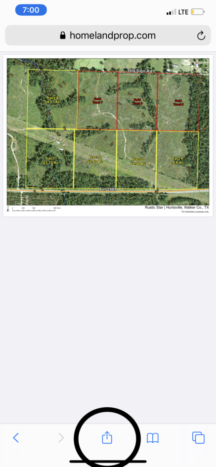
Step 4 – Click on the Aerial, Topo, or Location map on our website. The map will open in a new window. Click “Open in…” or the export icon , often located at the top or bottom of the screen.
Step 5 – This will bring up a menu with various apps. Select Avenza Maps.
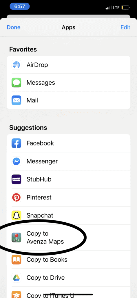
If this option isn’t listed, scroll to the right to find the icon with three dots “…”
You should find the Avenza Maps icon here if you didn’t find it before. Select “Copy to Avenza Maps”.
Click the export icon in the middle at the bottom of the screen.
Click “Copy to Avenza Maps”
The map should show up in the Avenza app. Avenza allows any user to have up to 3 maps at a time for no charge. Once you’re within the boundaries of the map, your location will show up with a blue dot.
Contrary to much of the “millennial” population, I am not a huge proponent of technology and feel it should be limited, but it has also assisted to push the land industry forward in more ways than just advanced mapping. Real estate agents in this industry should learn to read and understand physical maps from Day 1, but can supplement with tools like Avenza. Avenza Maps serves as an excellent tool for first-time land buyers and real estate professionals alike to understand the boundaries of each parcel of land that we didn’t have access to 20+ years ago.
Now you’re ready to use Avenza yourself while touring a HomeLand listing!
*HomeLand Properties maps are primarily used for illustration purposes only. A survey completed by a Registered Texas Professional Surveyor is the final determination for exact corners and boundary lines.