Homeland Properties
Sold: 62 Acres | CR 4375 & CR 4380
Land, Franklin County
CR 4375, CR 4380, Scroggins, Texas 75480
Listing ID: 43301
62.391 Acres$3,045 per acre
Property Description:
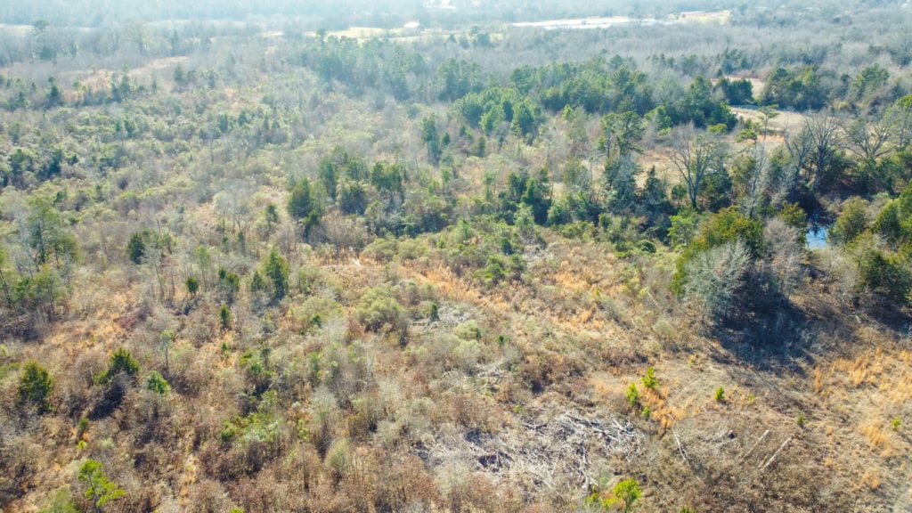
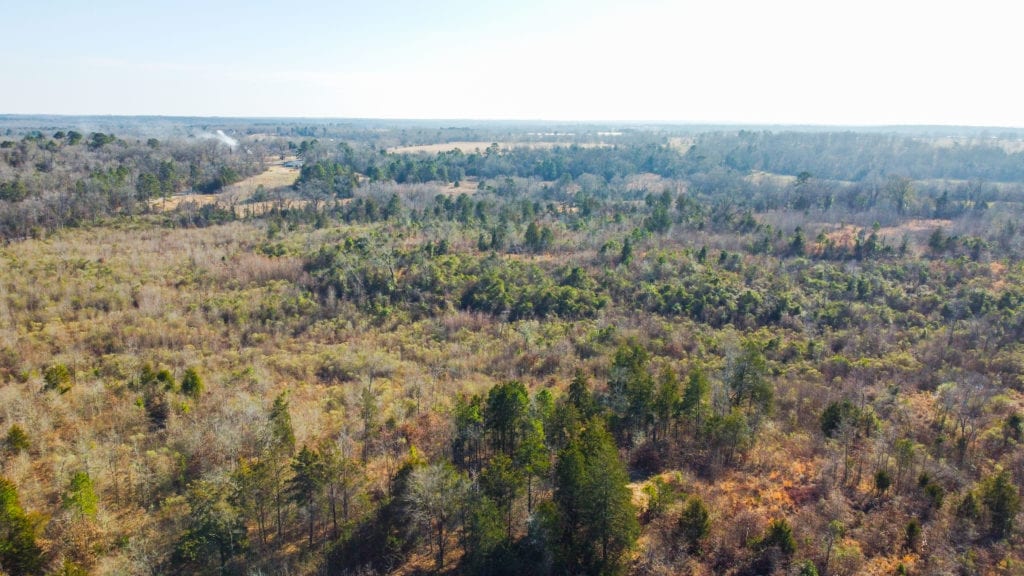
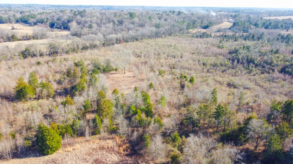
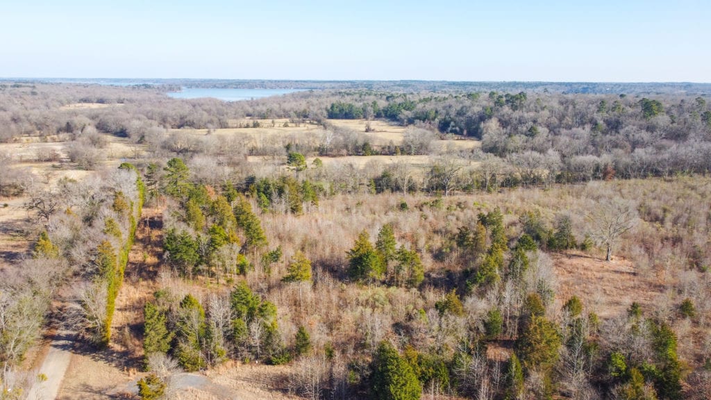
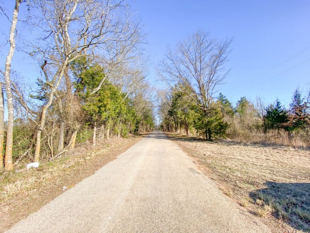
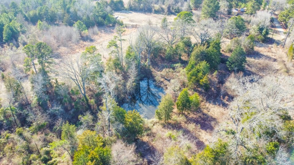
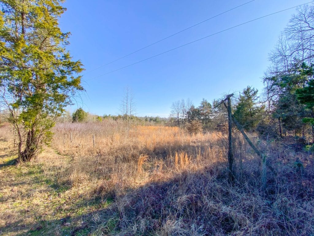
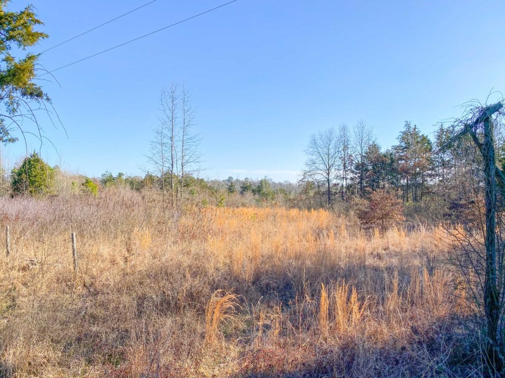
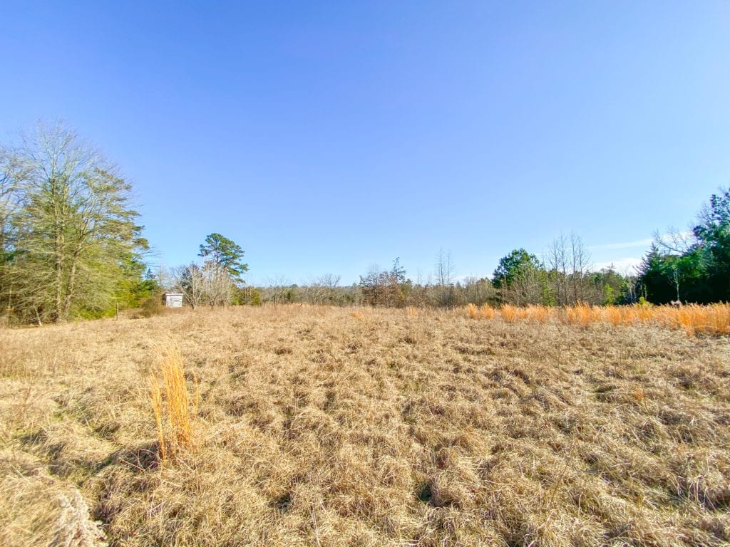
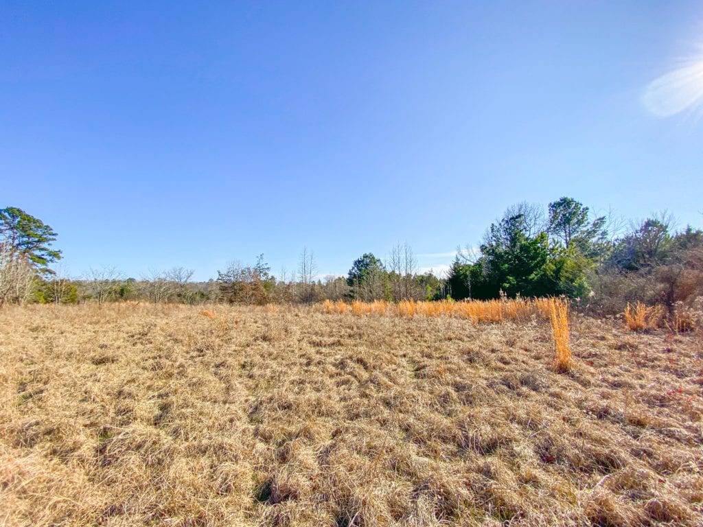
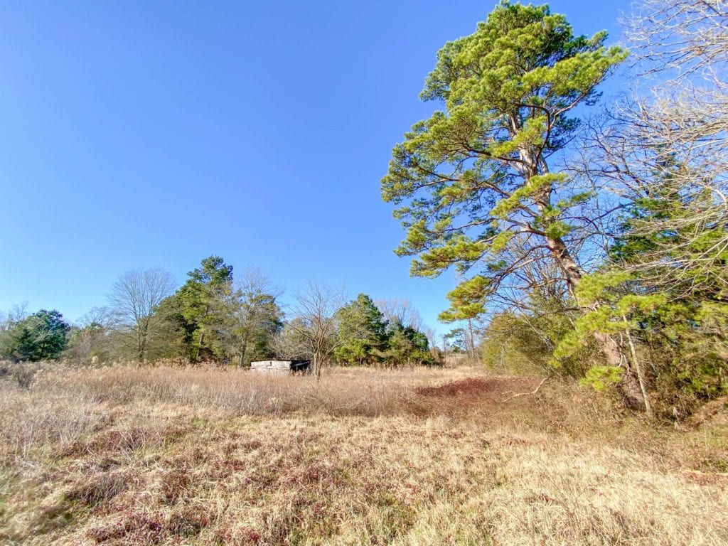
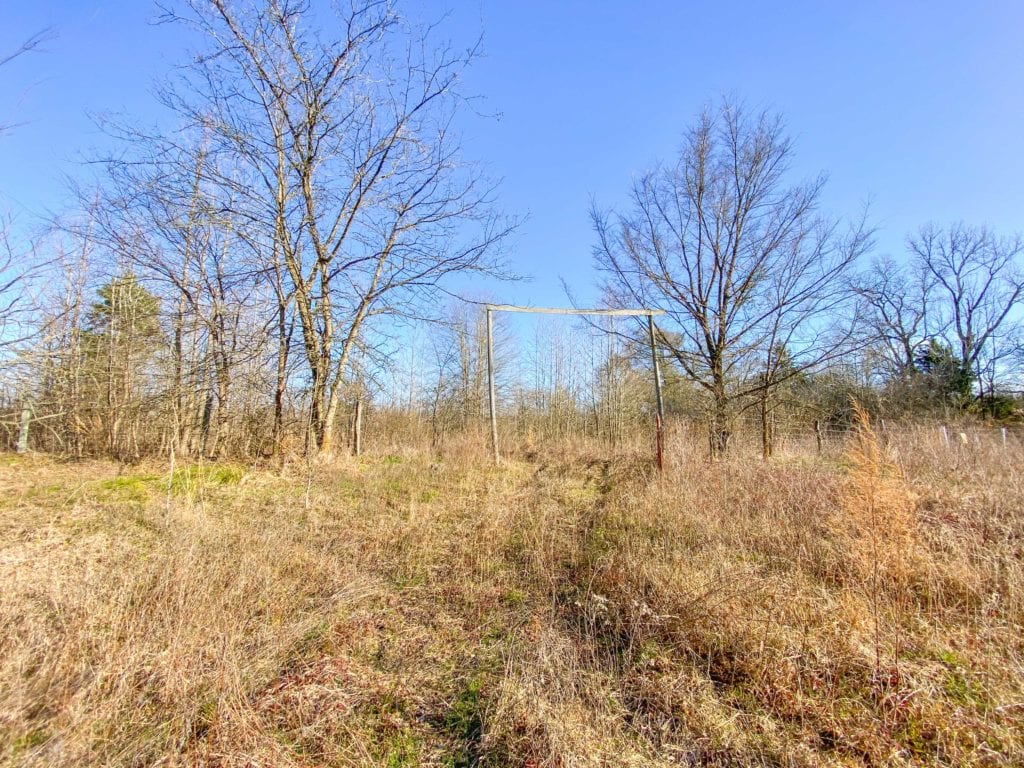
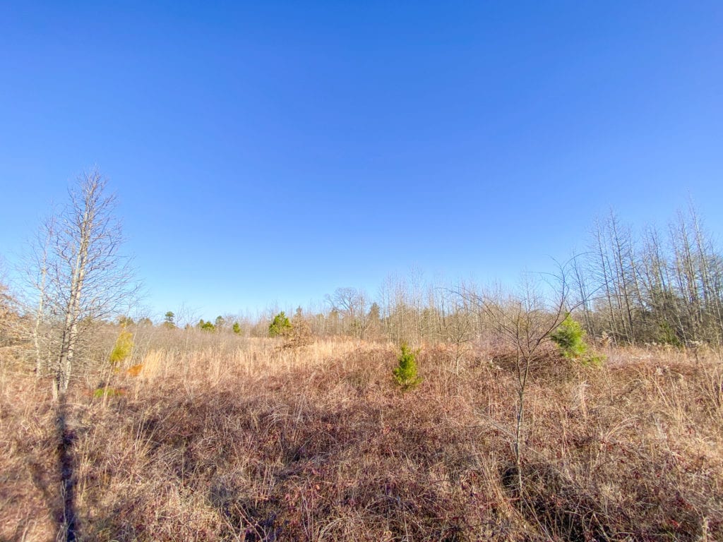
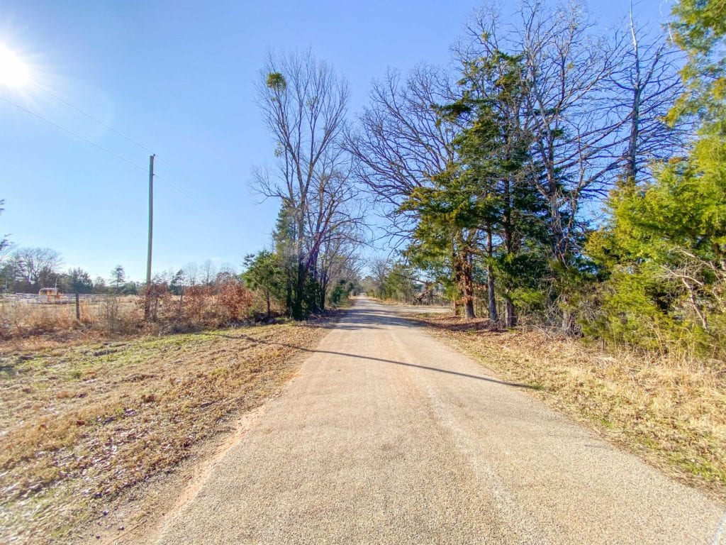
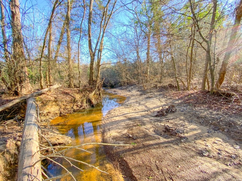
You found it! The property you’ve been looking for. This 62.391 acre tract presents itself very well to that family or individual that is looking for their getaway! This tract boasts the following features most buyers are looking for – A pond, a creek, rolling topography, a mix between wooded and open, proximity to Lake Bob Sandlin, hunting, electricity, double road frontage, rural yet still easy to get to, and more! Come make this property yours! Don’t hesitate to reach out for more information.
Other Details
Showing/Viewing Instructions:Buyer &/or agents must notify Homeland Properties of intent to view/tour & make advance appointment. A minimum of 24 hours’ notice is required. Buyers must be accompanied by broker/agent. Licensed co-brokers are welcome to show this property by advance appointment and will receive a co-broker fee if the co-broker accompanies their buyer from the first contact to the closing of a sale.
Directions:From Scroggins, head North on FM 115 toward CR 4420. Turn right on to FM 1448 E. Turn left to stay on FM 1448 E and continue onto CR 4375.
Access/Frontage:CR 4375 & CR 4380
Terrain Description:Level to sloped topography.
Restrictions:N/A
Land Use:Hunting, Leisure Ranch, Mobile Home Allowed, Unrestricted
Utilities:Public Water, No Sewer, Electricity
Utility District(s):Cypress Springs SUD by Extension
Legal Description:J. Max Survey, A-306, Franklin, Co., TX.
Corners/Property Lines:Visible and/or marked in field.
School District:Mount Vernon ISD
Financial
Earnest Money:5%
Tax ID:5807
Payment Options:Cash Sale, Conventional, Investor
Disclaimers
Listing Disclaimer:The use and/or reproduction of any marketing materials generated by HomeLand Properties, Inc. and/or its associated clients, including, but not limited to, maps, videos, photos, spreadsheets, diagrams, contracts, documents, etc. is strictly prohibited without written consent. The information contained herein is from sources deemed reliable but is not guaranteed by HomeLand Properties, Inc. The offerings are subject to change in price, errors, omissions, prior sales or withdrawal without notice. This disclaimer supersedes any & all information published by other MLS sites whether by permission or not, including, but not limited to, co-broker fees, if any. Acreage size and dimensions are approximate. County Appraisal District (CAD) market and tax values, as well as acreage size and/or shape, are not applicable to real estate market conditions and/or this solicitation, other than for ag value (1D1) purposes.
Legal Disclaimer:Size is approximate and subject to recorded legal description or surveyed gross acres to include, but not limited to, any acres lying within roads & easements. CAD shape files are not reliable. Shape files per maps herein are considered the most accurate available and are derived using the best information available, included, but not limited to, GIS data, field data, legal descriptions, and survey, if available.
Title and Survey Disclaimer:Expense subject to negotiation. Seller requires use of seller's preferred surveyor/title company.
Mineral Disclaimer:Oil and gas minerals have been reserved by prior owners.
Easement Disclaimer:Visible and apparent and/or marked in field., Pipeline, Electrical
Tax Disclaimer:Properties may qualify for future exemption subject to usage.
Property Managers


Property Photos:


-
Aerial

-
Topo

-
Location Maps

-
Survey

Showing/Viewing Instructions:Buyer &/or agents must notify Homeland Properties of intent to view/tour & make advance appointment. A minimum of 24 hours’ notice is required. Buyers must be accompanied by broker/agent. Licensed co-brokers are welcome to show this property by advance appointment and will receive a co-broker fee if the co-broker accompanies their buyer from the first contact to the closing of a sale.
Directions:From Scroggins, head North on FM 115 toward CR 4420. Turn right on to FM 1448 E. Turn left to stay on FM 1448 E and continue onto CR 4375.
Access/Frontage:CR 4375 & CR 4380
Terrain Description:Level to sloped topography.
Restrictions:N/A
Land Use:Hunting, Leisure Ranch, Mobile Home Allowed, Unrestricted
Utilities:Public Water, No Sewer, Electricity
Utility District(s):Cypress Springs SUD by Extension
Legal Description:J. Max Survey, A-306, Franklin, Co., TX.
Corners/Property Lines:Visible and/or marked in field.
School District:Mount Vernon ISD
Earnest Money:5%
Tax ID:5807
Payment Options:Cash Sale, Conventional, Investor
Listing Disclaimer:The use and/or reproduction of any marketing materials generated by HomeLand Properties, Inc. and/or its associated clients, including, but not limited to, maps, videos, photos, spreadsheets, diagrams, contracts, documents, etc. is strictly prohibited without written consent. The information contained herein is from sources deemed reliable but is not guaranteed by HomeLand Properties, Inc. The offerings are subject to change in price, errors, omissions, prior sales or withdrawal without notice. This disclaimer supersedes any & all information published by other MLS sites whether by permission or not, including, but not limited to, co-broker fees, if any. Acreage size and dimensions are approximate. County Appraisal District (CAD) market and tax values, as well as acreage size and/or shape, are not applicable to real estate market conditions and/or this solicitation, other than for ag value (1D1) purposes.
Legal Disclaimer:Size is approximate and subject to recorded legal description or surveyed gross acres to include, but not limited to, any acres lying within roads & easements. CAD shape files are not reliable. Shape files per maps herein are considered the most accurate available and are derived using the best information available, included, but not limited to, GIS data, field data, legal descriptions, and survey, if available.
Title and Survey Disclaimer:Expense subject to negotiation. Seller requires use of seller's preferred surveyor/title company.
Mineral Disclaimer:Oil and gas minerals have been reserved by prior owners.
Easement Disclaimer:Visible and apparent and/or marked in field., Pipeline, Electrical
Tax Disclaimer:Properties may qualify for future exemption subject to usage.