Homeland Properties
Sold: 9 Acres | FM 1416
Land, Newton County
FM 1416, Bon Wier, TX 75928
Listing ID: 40475
9.853 Acres$2,528 per acre
Property Description:
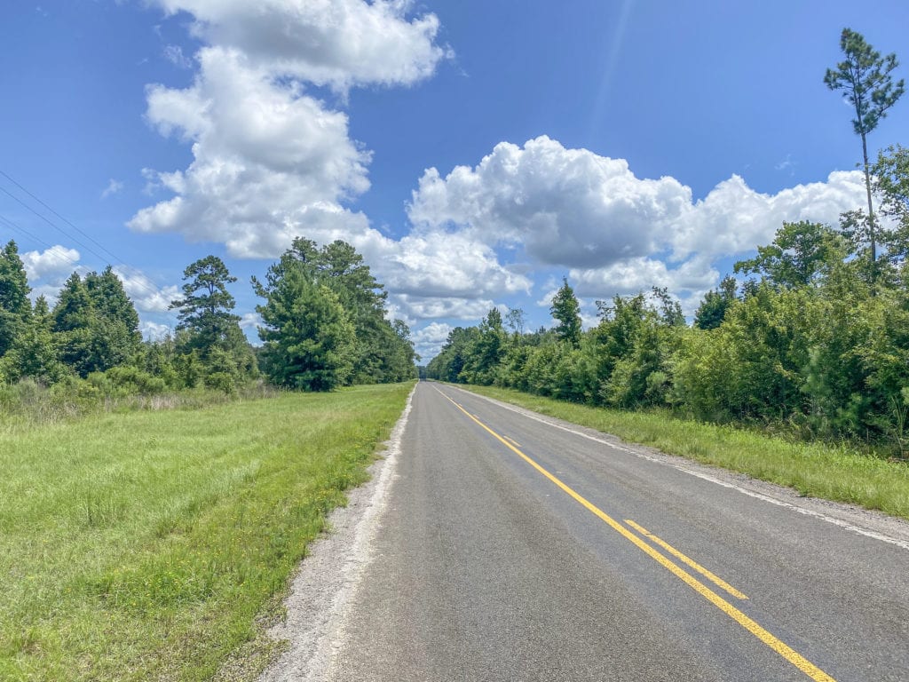
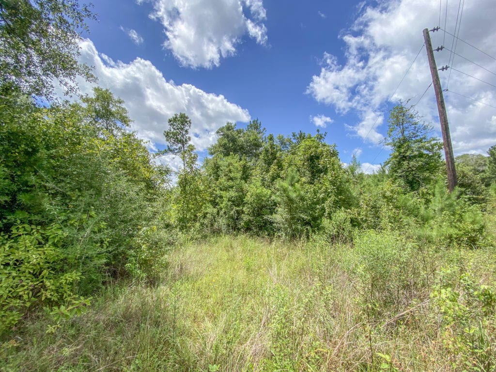
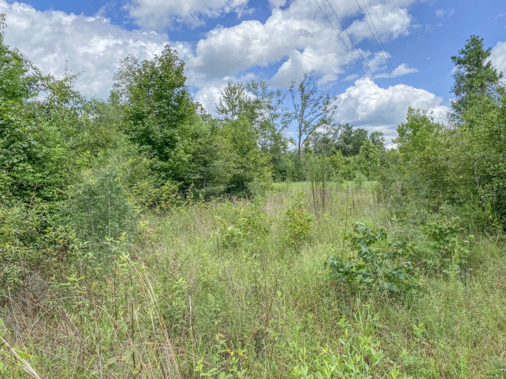
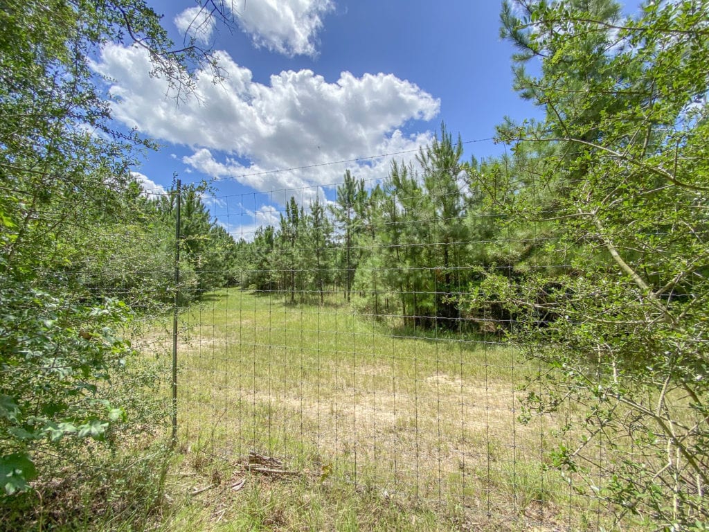
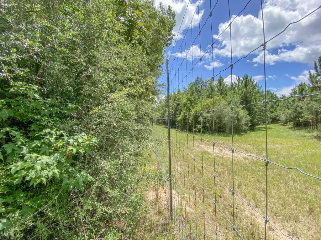
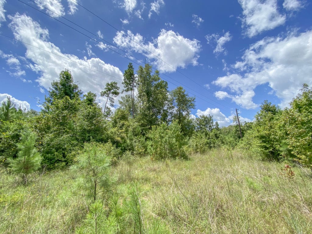
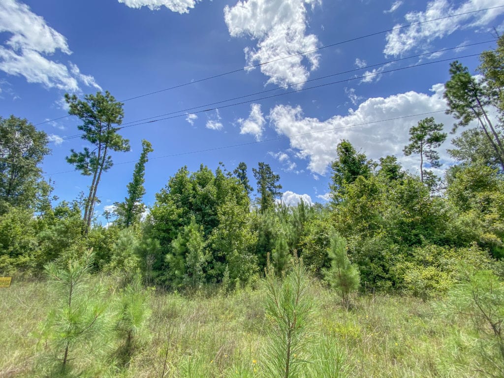
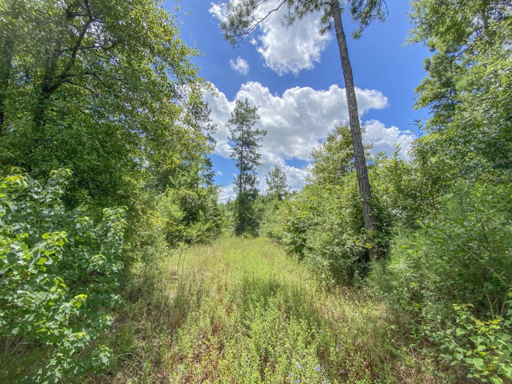
2 separate offerings: a 31.797-acre and a 9.853-acre tract. Partially wooded and cleared with FM blacktop frontage! Plenty of land to build on or put a mobile home. Bordered by large acreage properties! Brand new surveys available upon request for both properties. Call for more information!
Other Details
Showing/Viewing Instructions:Buyer &/or agents must notify Homeland Properties of intent to view/tour & make advance appointment. A minimum of 24 hours’ notice is required. Buyers must be accompanied by broker/agent. Licensed co-brokers are welcome to show this property by advance appointment and will receive a co-broker fee if the co-broker accompanies their buyer from the first contact to the closing of a sale.
Directions:From Kirbyville, take Hwy 96 S to FM 82 E, turn left onto FM 1004, turn right onto Hwy 87 S, then turn left onto FM 1416. Property will be marked by a HomeLand Properties sign!
Access/Frontage:FM 1416
Terrain Description:Level topography. Partial, densely wooded coverage. A small portion falls within the floodplain.
Restrictions:None Known
Land Use:Hunting, Mobile Home Allowed, Unrestricted
Legal Description:T. S. McFarland Survey, A-648, T-38, T-47, Newton Co., TX.
Corners/Property Lines:Visible and/or marked in field.
Property lines on plats are arbitrary and not visible in the field, for illustration purposes only.
School District:Newton ISD
Financial
Earnest Money:5%
Tax ID:19411
Payment Options:Cash Sale, Conventional, Investor, VA
Disclaimers
Listing Disclaimer:The use and/or reproduction of any marketing materials generated by HomeLand Properties, Inc. and/or its associated clients, including, but not limited to, maps, videos, photos, spreadsheets, diagrams, contracts, documents, etc. is strictly prohibited without written consent. The information contained herein is from sources deemed reliable but is not guaranteed by HomeLand Properties, Inc. The offerings are subject to change in price, errors, omissions, prior sales or withdrawal without notice. This disclaimer supersedes any & all information published by other MLS sites whether by permission or not, including, but not limited to, co-broker fees, if any. Acreage size and dimensions are approximate. County Appraisal District (CAD) market and tax values, as well as acreage size and/or shape, are not applicable to real estate market conditions and/or this solicitation, other than for ag value (1D1) purposes.
Legal Disclaimer:Size is approximate and subject to recorded legal description or surveyed gross acres to include, but not limited to, any acres lying within roads & easements. CAD shape files are not reliable. Shape files per maps herein are considered the most accurate available and are derived using the best information available, included, but not limited to, GIS data, field data, legal descriptions, and survey, if available.
Title and Survey Disclaimer:Survey on file. Available upon request. Seller requires use of seller's preferred title company.
Mineral Disclaimer:Oil and gas minerals have been reserved by prior owners.
Other reservations subject to title and/or sellers contract when applicable.
Easement Disclaimer:Power line
Tax Disclaimer:Approximately $5/Ac/Yr. Properties may qualify for future exemption subject to usage.
Property Managers


Property Photos:
-
Aerial

-
Topography

-
Location Maps

Showing/Viewing Instructions:Buyer &/or agents must notify Homeland Properties of intent to view/tour & make advance appointment. A minimum of 24 hours’ notice is required. Buyers must be accompanied by broker/agent. Licensed co-brokers are welcome to show this property by advance appointment and will receive a co-broker fee if the co-broker accompanies their buyer from the first contact to the closing of a sale.
Directions:From Kirbyville, take Hwy 96 S to FM 82 E, turn left onto FM 1004, turn right onto Hwy 87 S, then turn left onto FM 1416. Property will be marked by a HomeLand Properties sign!
Access/Frontage:FM 1416
Terrain Description:Level topography. Partial, densely wooded coverage. A small portion falls within the floodplain.
Restrictions:None Known
Land Use:Hunting, Mobile Home Allowed, Unrestricted
Legal Description:T. S. McFarland Survey, A-648, T-38, T-47, Newton Co., TX.
Corners/Property Lines:Visible and/or marked in field.
Property lines on plats are arbitrary and not visible in the field, for illustration purposes only.
School District:Newton ISD
Earnest Money:5%
Tax ID:19411
Payment Options:Cash Sale, Conventional, Investor, VA
Listing Disclaimer:The use and/or reproduction of any marketing materials generated by HomeLand Properties, Inc. and/or its associated clients, including, but not limited to, maps, videos, photos, spreadsheets, diagrams, contracts, documents, etc. is strictly prohibited without written consent. The information contained herein is from sources deemed reliable but is not guaranteed by HomeLand Properties, Inc. The offerings are subject to change in price, errors, omissions, prior sales or withdrawal without notice. This disclaimer supersedes any & all information published by other MLS sites whether by permission or not, including, but not limited to, co-broker fees, if any. Acreage size and dimensions are approximate. County Appraisal District (CAD) market and tax values, as well as acreage size and/or shape, are not applicable to real estate market conditions and/or this solicitation, other than for ag value (1D1) purposes.
Legal Disclaimer:Size is approximate and subject to recorded legal description or surveyed gross acres to include, but not limited to, any acres lying within roads & easements. CAD shape files are not reliable. Shape files per maps herein are considered the most accurate available and are derived using the best information available, included, but not limited to, GIS data, field data, legal descriptions, and survey, if available.
Title and Survey Disclaimer:Survey on file. Available upon request. Seller requires use of seller's preferred title company.
Mineral Disclaimer:Oil and gas minerals have been reserved by prior owners.
Other reservations subject to title and/or sellers contract when applicable.
Easement Disclaimer:Power line
Tax Disclaimer:Approximately $5/Ac/Yr. Properties may qualify for future exemption subject to usage.